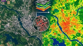

Tourism is an engine of economic growth, but rapid expansion brings critical operational friction: overtourism, shifting traveler preferences, and real-time destination management challenges.
Traditional paper-based surveys and static monitoring are too slow to address these modern demands. Industry leaders, researchers, and destination management organizations (DMOs) are turning to digital and mobile data tools, ranging from mobile survey apps to spatial GIS mapping and drones, to gather actionable real-time insights.
Core Value Drivers of Digital Data in Tourism
- Real-Time Sentiment Analysis: Capture instant guest feedback during their trip to fix service breakdown before negative reviews post online.
- Dynamic Crowd Control: Track visitor movement patterns to ease bottleneck congestion at cultural landmarks and heritage sites.
- Hyper-Personalized Offerings: Utilize preference data to tailor excursion packages and seasonal itineraries.
- Predictive Demand Forecasting: Anticipate peak travel windows, optimize staffing levels, and allocate local infrastructure resources efficiently.
Global Impact: Case Studies at a Glance
| Technology | Project Scope | Location | Primary Impact & Outcome |
| KoBoToolbox | Marketing Strategy Evaluation | Bhaktapur, Nepal | Replaced paper forms; accelerated survey response processing and cut field research costs. |
| Social Analytics | Visitor Satisfaction & Capacity Studies | Sardinia, Italy | Extracted crowd sentiment directly from online reviews (TripAdvisor/Booking.com). |
| GIS & GPS | Ecotourism Site Potential Mapping | Kwale, Kenya | Identified optimal conservation-first tourism zones using spatial terrain overlay. |
| Drones & Time-Lapse | Crowd Dynamics Monitoring | Girona, Spain | Captured overhead movement vectors to improve urban visitor routing and safety. |
| Digital Surveys | Resident Overcrowding Impact Study | Amsterdam, Netherlands | Gathered community sentiment fast to inform sustainable municipal housing policies. |
The 6-Stage Mobile Data Lifecycle
Implementing an end-to-end digital data workflow requires different tools at each operational stage:
- 1. Form Design (XLSForm, KoBo Form Builder, SurveyCTO): Build dynamic digital questionnaires featuring conditional skip logic, GPS tagging, photo inputs, and multi-language support.
- 2. Field Collection (ODK Collect, KoBoCollect, Esri Survey123): Deploy field staff with mobile devices to capture survey responses, signatures, and spatial coordinates.
- 3. Offline Capability (CommCare, Magpi+): Store response logs safely on local device storage when field teams operate in remote national parks or offline zones.
- 4. Cloud Synchronization (ODK Central, AWS S3, Google Cloud): Automatically upload cached data logs to secure central repositories once Wi-Fi or cellular networks connect.
- 5. Data Cleaning & Integration (Python, R, QGIS, Excel): Validate data integrity, filter bad entries, and merge spatial coordinates with geographic base layers.
- 6. Visualization & Action (Power BI, Tableau, Looker Studio): Transform raw survey logs into interactive dashboards for tourism boards and local businesses.
Real-World Applications & Industry Outcomes
1. Optimizing Heritage Marketing Strategies in Nepal
- Challenge: Historical sites like Bhaktapur struggled to measure the true return on investment of their international marketing campaigns using slow, error-prone paper forms.
- Solution: Researchers deployed KoBoToolbox on Android devices to capture structured feedback from incoming international and domestic travelers.
- Outcome: Replaced physical paper workflows, reduced survey processing times from weeks to hours, and enabled the Nepal Tourism Board to optimize campaign budgets based on real traveler profiles.
2. Mining Social Platforms for Regional Tourism Planning in Italy
- Challenge: Traditional door-to-door or intercept surveys in Sardinia were too costly to capture a statistically representative sample of annual visitors.
- Solution: Researchers at the University of Cagliari built automated database workflows to aggregate visitor feedback directly from online booking engines and travel review platforms.
- Outcome: Bypassed field survey expenses while capturing thousands of authentic, unprompted reviews to map visitor satisfaction against destination capacity.
3. Mapping Sustainable Ecotourism Horizons in Kwale County, Kenya
- Challenge: Unplanned tourism expansion threatened fragile coastal ecosystems and forest reserves like Shimba Hills.
- Solution: Field researchers used hand-held GPS units combined with GIS mapping software to document natural assets, roads, and native wildlife corridors.
- Outcome: Generated multi-layered spatial maps that highlighted viable ecotourism hubs without encroaching on sensitive ecological zones.
4. Managing High-Density Crowds in Spain via Drone Tracking
- Challenge: Narrow historical streets, such as Girona’s Cathedral Square, face severe bottlenecking that ground-level observers cannot measure accurately.
- Solution: Aerial drones captured overhead zenith time-lapse footage to analyze crowd movements during peak visitation hours.
- Outcome: Delivered precise movement mapping that allowed local authorities to redesign pedestrian traffic flows and deploy emergency services more effectively.
Looking to implement mobile data pipelines, GIS mapping, or advanced analytics within your organization? Explore upcoming professional short courses held in Nairobi, Kenya:
Mobile Data Collection using SurveyCTO
Data Visualization via Google Looker Studio & Power BI
Geospatial Mapping & Spatial Analytics using QGIS
Programs range from 5-day intensive workshops to full-scale technical bootcamps.