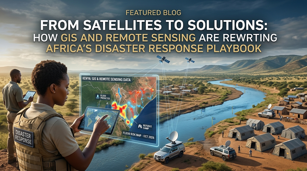
When floods swallow a settlement overnight, or a landslide erases a hillside community, the difference between chaos and a coordinated response comes down to speed and clarity. This is where Geographic Information Systems (GIS) and remote sensing step in, turning raw satellite imagery and spatial data into actionable, life-saving decisions.
The Growing Need for Spatial Data in East Africa
The numbers highlight a growing regional crisis. East Africa’s disaster burden has escalated sharply:
- Tanzania Floods: Torrential rains in 2024 killed at least 155 people, injured 236, destroyed over 51,000 homes, and impacted more than 76,700 hectares of farmland.
- Regional Displacement: Over 6.2 million internal displacements occurred across nine Eastern African nations, with floods accounting for roughly 69% of all incidents.
- Food Security: The UN’s Humanitarian Coordination Office (OCHA) reported that over 10% of the region’s crop-growing areas were devastated by extreme climate events in recent seasons.
Why GIS and Remote Sensing Matter Now
Climate volatility makes floods, droughts, wildfires, and landslides more frequent and less predictable across the continent. Government agencies and NGOs face increasing pressure to demonstrate that their disaster preparedness strategies are backed by reliable data.
The evidence for early action is compelling:
- Reduced Mortality: World Meteorological Organization (WMO) data shows that countries with robust multi-hazard early warning systems experience disaster-related mortality rates nearly six times lower than those without.
- Lower Damage Costs: Just 24 hours’ notice of an impending hazard can cut resulting economic damage by roughly 30%.
- High Return on Investment: Under the WMO’s Early Warnings for All initiative, every dollar invested in early warning systems yields up to fifteen dollars in saved assets and reduced disaster impacts.
GIS mapping and remote sensing are no longer optional tools; they are high-return investments in climate resilience.
Core Applications in Disaster Risk Management
Comprehensive training in spatial technology covers every stage of the disaster cycle: mitigation, preparedness, response, and recovery.
Practitioners utilize spatial tools to:
- Work directly with satellite imagery, drone data, and aerial photography to map flood-prone regions.
- Construct hazard maps integrating environmental, social, and economic metrics to evaluate vulnerability.
- Build integrated early warning systems driven by real-time spatial data streams.
- Execute post-disaster damage assessments that directly inform rebuilding strategies.
Developing High-Demand Geospatial Skills
For professionals, mastering geospatial data analysis is a major career differentiator. The capacity to translate raw spatial datasets into life-saving strategies remains a highly sought-after skill set across government and international development sectors. For organizations, building internal spatial capacity ensures stronger risk reduction policies, smoother team coordination, and optimal resource deployment when timing is critical.
Disasters are unavoidable, but how early we detect them and how effectively we respond depend on having the right tools and training in place.
Advance Your Career with Professional GIS Training
Ready to build these essential skills?
The GIS and Remote Sensing in Disaster Risk Management Training Course provides disaster risk managers, urban planners, GIS specialists, and government or NGO personnel with practical experience in hazard mapping, early warning systems, and post-disaster evaluation.
Explore the GIS in Disaster Risk Management Course and Register